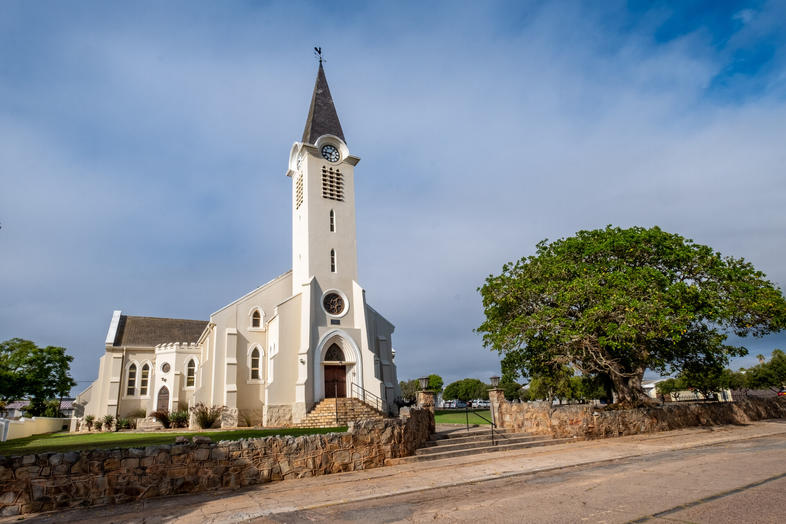
Province: Western Cape
Garden Route
Coordinates:34°12′S 21°35′E
Area:5.76 km2
Municipality: Hessequa
Albertinia is a small town in the southern part of the Western Cape, situated at the edge of the Klein Karoo. It lies about 350 km east of Cape Town along the N2 highway, making it a convenient stopover for travellers heading toward Mossel Bay, Riversdale, or Oudtshoorn. The town is nestled at the foot of the Langeberg mountains, surrounded by fertile farmland and vineyards, and is part of the Hessequa region, known for its aloe cultivation, traditional thatching reed
History of Albertinia
Albertinia is considered to be the endpoint of the Klein Karoo Wine Route. There are several vineyards at the foot of the mountains. It was laid out in 1900 on the farm Grootfontein, and the new village was proclaimed in 1904. However, it only became a municipality in 1920. It was named after Johannes Rudolph Albertyn.
The town is known for the aloes which grow in the area. The juice of these plants is used in the health and skincare industry.
In the late 18th century, a traveller and explorer, Sir John Barrow, discovered deposits of yellow and red ochre. it was not till 1925 that mining began. These mines are the main source of ochre today. Quartzite and kaolin are also mined in the district.
Another significant activity here is the harvesting of Thamnochortus insignis. A reed for thatching rooves. The plant occurs in the surrounding veld. Thatch harvested near Albertinia is supplied to markets locally and abroad.
The license plate prefix for Albertinia is CES, and the post code is 6695
Things to see and do in Albertinia
- Albertinia Museum 076 541-5811
- Tuinplaas and Tinytown
- Eilandskop pass
- Hessequa art route
- Soetmelksrivier pass
local WEATHER TODAY
Browse businesses and places to visit in Albertinia

Useful Numbers
Residents and visitors can find important local contact numbers below, including police, medical services, utilities, and community facilities
- Disaster Management – 082 443 0390
- Emergencies 028 713 2222
- Municipality;028 713 7858
- Police: 028 735 8040
- Traffic department: Riversdale– 028 735 8040 / 028 713 7817 or 028 713 7818
- Fire: 10177 | 044 279 1415
- `Water:028 713 7858
- Electricity:028 713 7858
- Ambulance: 10177
- Post office;28 735 8023
- Library:028 735 8023
- Albertinia sports stadium:
- Closest hospital;Riversdale Hospital-028 713 2445
- Clinic-028 735 1045
- Pharmacy;Emarmed Medical Centre-028 735 1942
- SPCA: Garden Route SPCA-044 693 0824
- Schools:
- High School -028 743 1357
- Oker Primary School-028 735 1095
- Museum;076 541 5811
- Tourism; 028 735 1000
- Colourdots is an independent regional information resource for the Western Cape.
Learn more about the project HERE
Updated January 2026


