History of Dunoon
- Province; Western Cape
- Coordinates ; 33.819°S 18.540°E
- Area ; 0.99 km2
- Northern Suburbs
- Municipality City of Cape Town
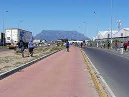
This is a township near Killarney Gardens in Cape Town with great views of Table Mountain, began development in 1996 when the first erf was surveyed. Initially known as Site 5, Dunoon saw some formal housing construction, but it quickly grew into an informal settlement due to a large influx of people seeking better economic opportunities in Cape Town. Many new residents arrived from rural areas and other parts of South Africa, causing the township to expand rapidly.
Although it initially consisted mainly of informal housing, efforts by the government and non-governmental organizations have aimed to improve living conditions by constructing more formal houses and providing essential services.
The postcode for Dunoon is 7441 (streets) and 7438 (boxes)
local WEATHER TODAY
see all listings in dunoon

Useful Numbers
- Police: 021 528 3800
- Traffic department: Milnerton – 0860 103 089
- Fire: Milnerton-021 400 6949
- Water: 0860 103 089
- Electricity: 0860 103 089
- Ambulance: 10177 -Medics In Motion – Ambulance service-021 551 3386
- Post office; 021 556 3561
- Closest hospital;021 200 4500
- Pharmacy;
- SPCA: Cape of Good Hope SPCA-021 700 4140
- Community centre:021 814 1527
- Schools;
Sophakama Primary-021 557 7125
Inkwenkwezi Secondary School-021 556 4160
Du noon Primary School-083 608 4828
Du Noon Educare Non-profit School-021 557 5063
Silver Leaf Primary School-074 166 9793