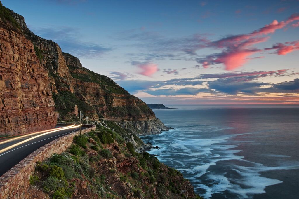
Chapman’s Peak
Chapmans Peak Drive was conceived by Sir Nicolas Fredrick de Waal as he realised that a road was needed to link to Hout Bay and Noordhoek. It is one of Cape Town’s most scenic drives and is a must-see Mother City stop for tourists. Locally known as “Chappies”, the peak was named after John Chapman. Many believe Chapman was a brave mountaineer or governor, but he was a Captain’s mate on the British ship, Contest. In 1607 it found itself unable to move as there was no wind that day. The skipper of the ship sent his pilot to row ashore in the hopes of finding provisions. The pilot’s name was Chapman.
The bay was later recorded as Chapman’s Chaunce, which means Chapman’s Chance. The name became the official name of the bay on all East India charts.
From the peak, there are majestic views of sheer drops to the sea below with towering mountains above. The 9km route, (with its 114 curves.) is one of the lesser-hiked peaks on the Table Mountain chain but is an absolute paradise for hiking enthusiasts.
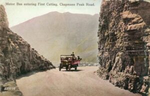
Chapman peak 1920s
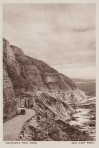
 Chapman’s Peak Drive (1940)
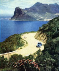
The rocky coastline of Chapman’s Peak (593m) is the southerly extension of the Constantiaberg and is a great hiking spot. The road was constructed during the First World War. There is a myth that Italian prisoners of war made Chapman’s Peak Drive. However, during the First World War, the Italians were allies. Local convict labour was used. Construction began on the road in 1915. Surveyors and workers faced steep, unstable terrain, often requiring them to work on hands and knees. Despite these difficulties, the project progressed, with the first portion of the road opening in 1919. However, it took seven years to complete, with the road finally opening to traffic in 1922.
The route starts in Hout Bay and the climb winds steeply up to Chapman’s Point, where you can enjoy stunning views of the sandy beaches down below, the road then reaches lower levels again at Noordhoek. Toll fees are paid at the Toll Plaza where administration of the drive takes place and you can also sign up as a Frequent User. Public ablutions are available here. The history of the mountain pass is interesting and dramatic.
Hiking “Chappies”
This moderately difficult 3-hour hike begins at Chapman’s Peak Parking Area. Make your way to the checkpoint for motorists. The sign points to the beginning of the hike. The route is very well maintained and easy to follow, paved with sandstone rocks most of the way. The slopes even out near the top, turn right and keep going towards Noordhoek along a slowly rising trail. You will reach the summit of Chapman’s Peak. The scenery is spectacular. Around the first peak, you will see Hout Bay. Further on you will see great views of Fish Hoek, Noordhoek Beach, and even Gordon’s Bay and Table Mountain on clear days To the south is Cape Point and Kommetjie can be seen.
A fairly difficult hike connects Chapman’s Peak and Silvermine. It takes about 6 hours to complete. This is not a circular route and transport will be needed. To access Drive toward Noordhoek, turn right into Silvermine Road, and then right at the T-junction into Noordhoek Main Road (M6). Pass the Noordhoek Village Centre on your right, and two paddocks on your left before taking a left into Avondrust Circle. At the second road, Beach Road turn right and follow the marked signs to the beach parking lot. The route ascends from Noordhoek Beach to Chapman’s Peak, descends to the other side, and then climbs back up again before the final descent down to the Silvermine dam in Silvermine-west. While there are some steep parts of this hike, most of the slopes are gradual. Accompanied children from ages 10 and up are allowed to do this hike and dogs are also welcome.
Take a virtual drive over Chappies
Some history of Chapman’s Peak