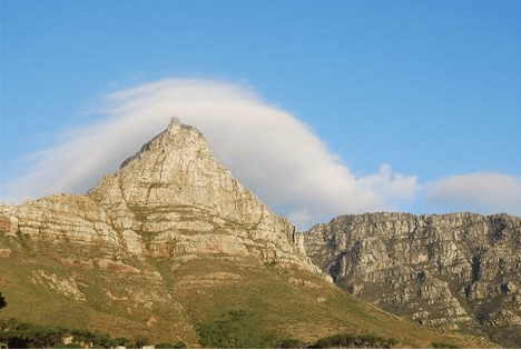
Devil’s Peak
Devil’s Peak (Afrikaans: Duiwelspiek) is the mountain to the left of the backdrop to Cape Town. when looking at it from the city centre, as in the iconic view of Table Mountain, To the right are Lion’s Head and Signal Hill. Devil’s Peak stands 1,000 metres (3,281 ft) high. originally the Dutch called it Windberg and later the English named it Herbert’s Mount after Humphrey Fitz Herbert of the English East India Company.
The University of Cape Town and Rhodes Memorial are on the eastern slopes of Devil’s Peak. Groot Schuur Hospital and Mostert’s Mill are on the lower slopes of the same side.
King’s blockhouse and several cannons which were intended to defend the city from attack are also on the slopes.
The King’s blockhouse was built by the British between 1795 and 1803 as a defence against any enemy attack. combined with the Prince of Wales and the York Blockhouses formed a defensive line to the land approach to Cape Town and Table Bay. It can be reached by hiking a steep path from behind the Rhodes Memorial You can walk to the end of Tafelberg Rd from the corner of Kloof Nek. From here you can follow the contour path above Newlands Forest to Skeleton Gorge and down into Kirstenbosch Gardens It takes one and a half hours to complete the hike over a distance of 1.8 km
Pine trees and gum trees were planted commercially on the Southern slopes from the 1850s for about 100 years. Most of these trees have been removed. However, some trees have been left on the lower slopes.
In the 1930s a few Himalayan Tahrs escaped from Groot Schuur Zoo. For years they bred till their population numbered over 700. Most were eliminated in a culling programme but there are still a few left. There are also some local small antelope and some eland, wildebeest, and zebra on the lower slopes of the mountain. You can also see porcupines, caracals, and many bird species.
The English name Devil’s Peak is a 19th-century translation from the Dutch Duivels Kop and is said to be from the story of a Dutchman called Jan van Hunks. It is also possible the name was a corruption of the name Duifespiek (“Dove’s Peak”) to Duivelspiek (“Devil’s Peak”), The Dutch words for devil and dove are quite close in sound. Another story tells of when Vasco de Gama rounded the Cape in 1497 he and his sailors named the area at the southernmost tip of Africa, Cabo di Diab the Devil’s Cape because of the wind and stormy weather.
There are several well-trodden walks and hikes up to the top of Devil’s Peak, the west slope being the easier approach.
The only safe climb to the peak is from the Saddle, between Table Mountain and Devils Peak. There are three routes to reach the Saddle: from Tafelberg Road on the city side, the upper contour path from Mowbray Ridge, or up Newlands Ravine from Newlands Forest. When you reach the saddle you will find the path to the summit. Enjoy the 360° view
The top of Devil’s Peak is exposed to wind and mist, so hikers need to take care. Several of the descents on the South side tend to be steep and soggy and a bit dangerous, particularly in winter. The southern slopes were originally covered with indigenous forest.
The North slopes are home to Cape peninsula Shale Renosterveld vegetation but are prone to fires.
Routes
Tafelberg Road
To get there you need to drive towards Table Mountain, drive 3 km past the cableway, and park there. The views along this route are spectacular. In winter you may see waterfalls. The path is rough and steep and often windy. On a dry day, it is slippery underfoot towards the top where there is beach-like sand There and back takes about 4 hours.
Knifes edge hike
Park at Rhodes Memorial. Follow the signs to the Kings Block House. Then climb up Mowbray Ridge before you get to Knife’s Edge. Keep on to the minor summit of Devil’s Peak. It is advisable that if you are inexperienced at climbing you should join someone more experienced as this climb is difficult, steep, and tricky and takes between 2 and 4 hours depending on fitness levels.
Newlands Ravine
There is another route that also begins at the Rhodes Memorial parking lot. Take the steps in the far-left corner, then continue towards a T-junction, where you must turn right. Continue on this path. Just before the turnstile turn left and you will get to the Contour path. It takes about 4 hours.
Important numbers to have when visiting Table Mountain National Park venues
- Emergencies:021 480 7700
- Medical emergencies from a cellphone:112
- Table Mountain National Park: 021 957 4700/ 0861 106 417
- Wilderness Search and Rescue: 021 948 9900
Is this your business?Claim it now.
Make sure your information is up to date.Colourdots is an independent Western Cape regional information resource. Learn more about the site here.