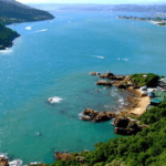
Knysna Lagoon
The Knysna Lagoon opens beyond the two sandstone cliffs known as the Knysna Heads. This area was once proclaimed by the British Royal Navy to be the most dangerous harbour entrance in the world.
The town of Knysna rose around the lagoon which is more of an estuary than a lagoon. The lagoon covers about 1,633 ha. It stretches from the Knysna Heads to Charlesford Weir on the Knysna River. The estuaries’ widest part is about 3 km wide and at the heads, it is just 230 metres wide. The tide water flows through the heads at a rate of one to two thousand cubic metres per second. The tide reaches about 17 km upstream. There are five freshwater rivers that flow from the surrounding Outeniqua Mountains into the Indian Ocean.
The difference between high and low tides is very marked. At low tide, you can walk through the shallow water all the way to Leisure Isle to the Heads. Conservation at the estuary is vitally important. The area hosts a huge diversity of species.


