Maclears Beacon
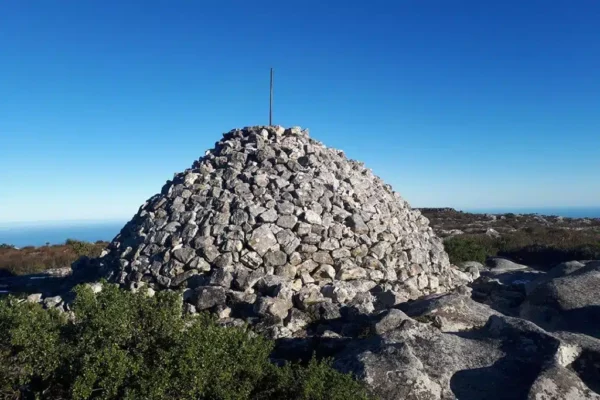
Maclear’s beacon on top of Table Mountain was originally built in 1865 and is still used by cartographers today. Irish-born Maclear, a medical doctor who was also a keen astronomer, served as Her Majesty’s Astronomer and Director at the Royal Observatory at the Cape from 1833 to 1870. In 1865, Maclear instructed his assistant to build a stone cairn on the top of Table Mountain for use in a trigonometric survey. The beacon is used for the measurement of the earth’s circumference. It is on the eastern end of the Table Mountain plateau. The beacon is 1,086 metres above sea level and it marks the highest point on Table Mountain. It can be seen from the observatory, Cape point and from Robben Island Maclear was knighted in 1860 for his achievements in astronomy and he died in 1879 in Mowbray. In 1929, the pile of stones collapsed and it was restored in 1979 to commemorate the centenary of Maclear’s death.