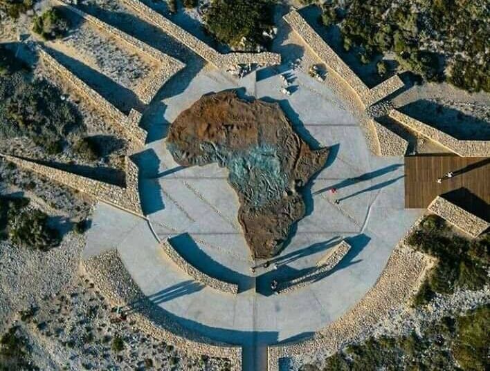
The Southernmost tip of Africa features a new must-see attraction called the Iconic Map of Africa Monument. A 3D relief map, 30 metres circumference
The Agulhas National Park is a South African national park located in the Agulhas Plain in the southern Overberg region. The park stretches along the coastal plain between the towns of Gansbaai and Struisbaai and includes the southern tip of Africa at Cape Agulhas.
reservations@agulhasnationalpark.co.za