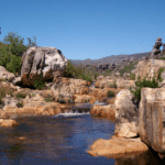
The Ratel River
The Ratel River is on the western side of the Agulhas National Park. It is considered as an important heritage site. Quite apart from all the ships that were wrecked close to the mouth of the river, there is a lot of evidence of prehistoric habitation. There are several middens and pottery shards and other goods have been found.
The river and its tributaries form a coastal [lain as the rivers flow sluggishly as it feeds two coastal lakes. The waters are alkaline and brackish as it passes over limestone-bearing Strandvlei sands.
Upstream the water has a lower PH. The vegetation ( mainly fynbos0 affects the water draining off it. Vegetation in the catchment is typically acidic.
Ratel Rivier. Latitude-34.15333° or 34° 9′ 12″ south. Longitude. 20.07958°


