History of Moorreesburg
- Province: Western Cape
- West coast
- Coordinates: 33.1452° S, 18.6680° E
- Area:27,8 km²
- Municipality: Swartland
Wheat farming area
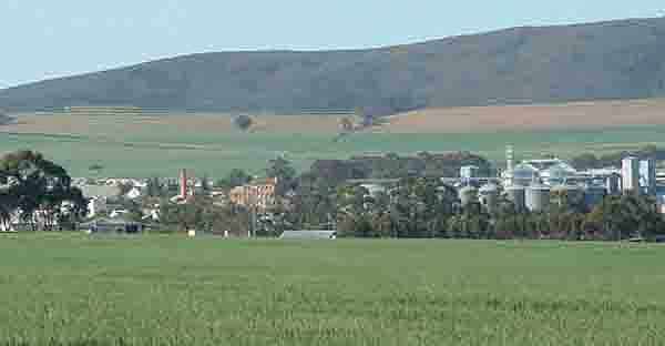
The land in Moorreesburg has been used for large-scale wheat farming for most of its history and it has become known as the breadbasket of South Africa. Moorreesburg was named after J.C. le Febre Moorrees (1807–1885), minister of the Swartland congregation of the Nederduitse Gereformeerde Kerk from 1833 to 1881.
Wine and olive production also take place in the surrounding farmland. The oldest wine estate in the area dates back to 1696.
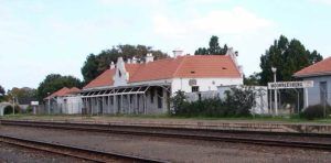
Moorreesburg was laid out in 1879 on the farm Hooikraal and was administered by a village management board from 1882. It attained municipal status in 1909. The railway line reached the town in1902.

Moreesburg station, Vintage picture from Saartjie Klipkop.
The license plate prefix for Moreesburg is CEA. The postcode is 7310
Things to see and do in Moorreesburg
- !863 Steel girder bridge over the Berg River
- Wheat industry museum is one of only three wheat museums in the world.
WEATHER IN MOorREESBURG TODAY
see all listings in Moreesburg
Useful Numbers
- Municipality: 022 433 2246
- Police: 022 433 8660
- Traffic department: 022 433 2246
- Fire: 022 433 8702
- Water:Electricity:
- Ambulance: 10177
- Post office; 022 433 1222
- Local newspapers:
- ” Die Courant”: 022 487 3221
- Swartland Gazette: 022 482 3817
- Library: 022 433 1647
- Closest hospital;/ Clinic 022 433 1666
- Pharmacy; 022 433 1001
- SPCA: Swaartland spca 022 492 2781
- Schools:
- Dirkie Uys primary school 022 433 1082
- Dirkie Uys High School 022 433 2253
- KleinKaringmelk vlei primary 022 433 1025
- Museum; Wheat Industry museum 022 433 1093
- Tourism 022 433 2380
Towns in the Swartland district include: Chatsworth; Darling; Grotto Bay; Jakkalsfontein; Kalbaskraal; Koringberg; Malmesbury;; Riebeek kasteel and Yzerfontein;


