History of Napier
- Province: Western Cape
- Overberg
- Coordinates;34.4754° S, 19.8961° E
- Municipality; Cape Agulhas
Napier exists because of a tiff between two farmers.
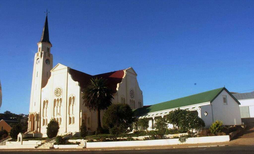
This is a village at the foot of the Soetmuisberg, founded due to an unresolved argument over the location of a new Dutch Reformed Church. Michiel van Breda and Pieter Voltelyn van der Byl, the two farmers involved, built a church on their respective farms, Langefontein and Klipdrift. In 1836, the town of Napier formed around the church that Pieter Voltelyn van der Byl built on Klipdrift or Klipfontein, in 1838, attaining municipal status within the same year. In 1896, a management board was instituted. In March 1840, it was named after Sir George Thomas Napier, the
Governor of the Cape Colony from 1837-1844.1
Named after British Governor of the Cape Colony from 1837-1844.George Thomas Napier. The church features a Greek cross design, a beautiful teak interior, and a solid copper pipe organ. The Feeshuis, one of the oldest buildings in town, originally served as a slave quarter and later as a wine cellar.
The area once boasted three mills, the remnants of which can still be found. The town’s historic leiwater (irrigation canal) system, a vital water source for animals and agriculture, is also partially preserved.
Doomed gold rush
Around the turn of the century, miners searched for gold on the farm Hansiesrivier, establishing the Napier Gold Mining Company and issuing shares. However, they found little to no gold, and the company eventually folded.
Today, the area is also known for its strawberry farms.
The postcode in Napier is 7270
LOCAL WEATHER TODAY
see all listings in napier
Things to see and do in Napier:
- The watermill at the municipal offices
- The Kakebeenwa Monument, erected in 1938, commemorates the Voortrekkers’ Great Trek.
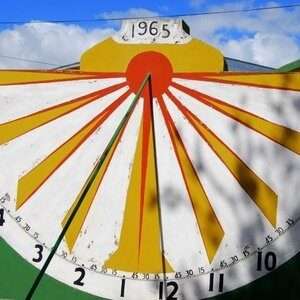
- The sundial at the municipal offices was built by Danie du Toit in 1965 who built it just by meticulous observation. It is accurate within 30 seconds.

- The Patat Fees is held in June, marketing@napierwinepatatfees.co.za
- Kakebeenwa monument. An Ox-wagon monument on the main road, the monument commemorates the Ossewa Trek of 1838.
- The Grootberg Hiking Trail is 8km long and takes about 3.5 hours. Drive out of town on Plein Street and up along the gravel road. Park at the FM tower and head for Grootberg Beacon. Continue on to Sopieshoogte. Take in a view over the town of Napier. Turn round and return the way you came,
- Sports Pavilion built in 1938
Useful Numbers
- Police: 028 423 8000
- Municipality; : 0284233231
- Traffic department: Bredasdorp – 028 424 2440
- Fire: Bredasdorp-028 425 1690
- Water: 028 425 5601
- Electricity:028 425 5604
- Ambulance: 10177
- Post office;028 423 3281
- Library: 028 423 3257
- Closest hospital; Provincial Hospital: 028 424 1167
- Clinic-028 423 3008
- Pharmacy; Bredasdorp Primary Healthcare Pharmacy-028 425 1193
- SPCA: Animal Anti-Cruelty League (Bredasdorp): 082 898 0787 / 028 425 2270
- Schools: Protea Primary School-028 423 3563
Agulhas School of Skills-028 423 3572 - Residents assosciation
- The postal code for Napier is 7270
- Cape Agulhas Tourism Office: 028 424 2584


