History of St James
- Province; Western Cape
- Coordinates: 34°07′08″S 18°27′33″E
- Municipality: City of Cape Town
- Area: 0.37 km2
St James is a small suburb along the False Bay coast just South of Muizenberg, it was named after the Catholic church in the area, built in 1880. The suburb grew mostly from 1910 to 1950 when the railway line was extended towards Simon’s Town. The homes mostly built from stone, limestone and plaster date back to the colonial era. St James cottage, built in 1853 was owned originally by Abraham Auret. Here he helped prisoners to hide in the loft during the Anglo-Boer war en route to cross False Bay.
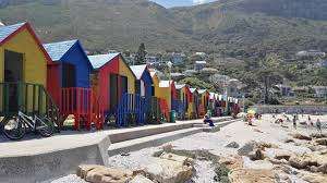
The iconic beach still has the familiar colourful beach huts that have been a central feature since the early 20th century. These changing huts have become a beloved symbol of the area. The area also boasts the historic Anglican Church, established in 1863, which is a key landmark reflecting the suburb’s early colonial roots.

Vintage picture of the Main Road
The postcode for St James is 7945
WEATHER IN ST JAMES TODAY
see all listings in St James
Things to see and do in St James
- Whale watching in season
- Great views of False Bay from Boyes Drive.
Useful Numbers
- Police: Fishhoek, 021784 2700
- Traffic department: Fishhook 021 784 2160
- Fire: Fishhoek 021 480 7700
- Water: 0860 103 089
- Electricity: 0860 103 089
- Ambulance: 10177
- Post office; Muizenberg 021 788 2675
- Closest hospital; False Bay Hospital 021 7821121
- SPCA: 021 700 4140
- The City of Cape Town Public Emergency Communication Centre is available 24/7 For all life or property-threatening emergencies, call 021 480 7700 from any phone or 107 from a landline or report online at https://bit.ly/3o4Ji3K


